
Oyster Appellations of the Pacific Northwest
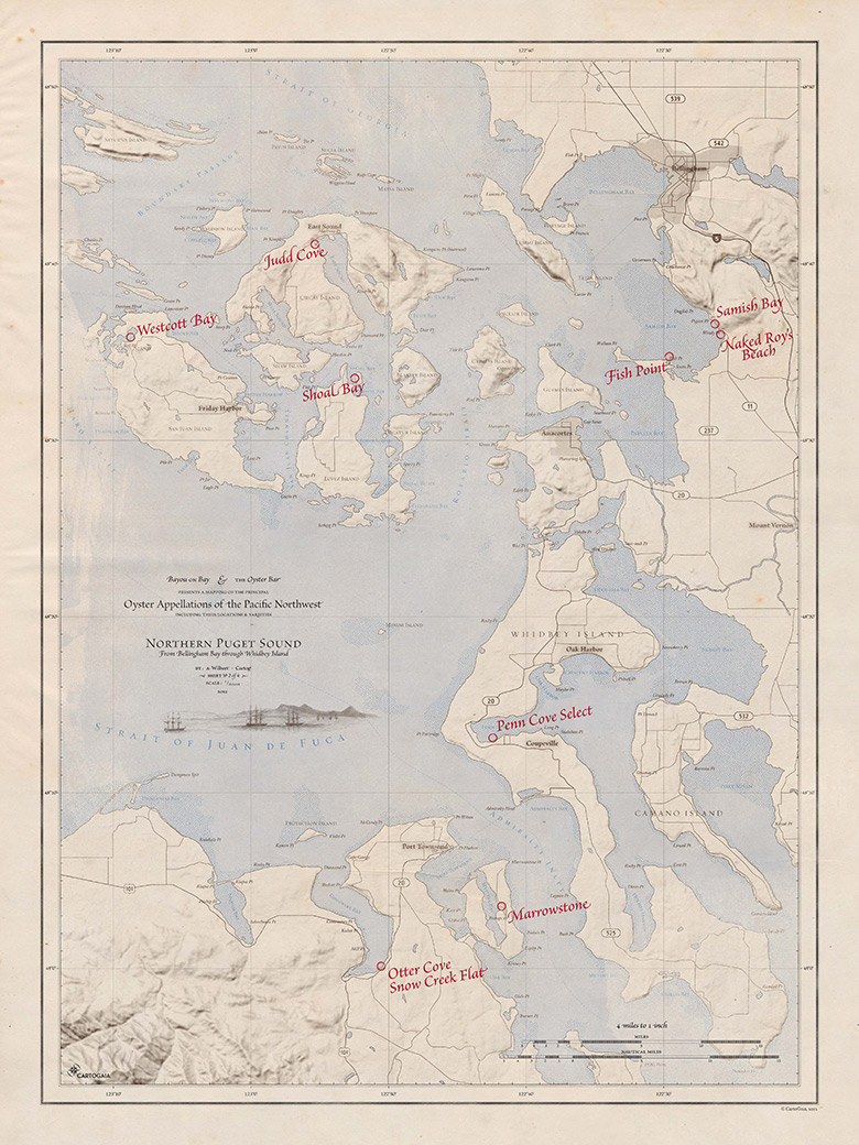

Northern Puget Sound – sheet 2 of 4
My current work is a series of four maps that will hang in a local restaurant and oyster bar. The owners of this Pacific Northwest restaurant wanted a wall reference to the local varieties of oyster that they serve.
Each sheet will be a framed 18"× 24" print that needed to fit in with the vintage decor of the restaurant. This map covers the northern half of Puget Sound, Washington. The other three maps will cover Hood Canal and South Puget Sound, Willapa Bay on Washington's western coast, and the southern half of Vancouver Island and the Strait of Georgia in British Columbia. The cartographic style is modeled after the charts from George Vancouver's visit to Puget Sound published 1798 and the US Coast Survey published 1853. The growing and harvest locations for each oyster variety are marked as if they were annotated by hand long after the initial publication of the map.
Various masks were used to create the aged effects that were modeled after real-world processes. Copperplate etchings are prone to wear during use and cleanup. Often this results in the erosion of fine lines such as graticules and neat lines in subsequent printings. Older maps and charts were often hand colored with watercolor washes after the initial printing of the linework. This exposes irregularities in the texture of the paper stock and leaves brush strokes in large areas of color. It is these subtle quirks in printmaking that gives a printed piece character and personality unmatched by digitally created solid fills and impossibly perfect lines.
This series of maps was created with ArcGIS for data collection and organization, Adobe Illustrator for linework and cleanup, and Photoshop for final color and texture. The type is set in Brioso Pro, Adobe Caslon, and Requiem Text.